
Valle Del Fluvione
Length: 16000 mt.
Direction of travel: orario
Travel time: mezza giornata
difficulty : I - Intermediate
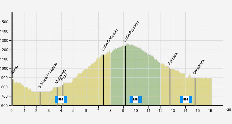
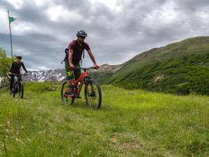
The route starts from Balzo, the municipal centre of Montegallo, and winds through other small villages forming part of a landscape dominated by the eastern slope of M. Vettore (2476 m.), the highest peak of the Sibillini. M. Vettore was once nicknamed "the factory of clouds” because sudden weather changes often occur around the summit. From its marl-sandstone base M. Vettore rises over 1,600 meters with steep slopes (prone to avalanches) especially on the south-eastern side, visible from Colle Galluccio, where the rock face of calcareous layers of stone includes cornelian minerals. From the Montegallo side which leads to Il Pizzo (2281 m.) and to M. Torrone (2117 m.), sharp glacial ditches and gullies convey source water and rainwater, especially abundant in the spring, to the river Fluvione. The fauna of the area is characterized by interesting species such as deer, wolves and wild cats, as well as numerous birds typical of the wooded areas like the lesser spotted woodpecker, the sparrow hawk and the rare astore, which may derive its name from the nearby hamlet Astorara. Along this route is the impressive monastery of S.ta Maria in Lapide, of uncertain origin, and completely rebuilt in the second half of the fifteenth century.


Copyright © 2001-2020 Parco Nazionale dei Monti Sibillini
Tutti i diritti riservati - all rights reserved
Revised -- 02.09.2020
URL:
percorsiE.php


