HIKING TRAILS

WARNINGS
After the earthquake of 2016... read... some hiking trails suffered damage due to landslides and geological problems that completely or partially prevent their use. To allow a more immediate reading of the status of the hiking trails and the relative usability, the following graphic is used::
green stamp The green symbol indicates the usable paths, yellow stamp he yellow symbol indicates the paths with usable sections and closed sections, yellow stamp The red symbol indicates the closed paths.

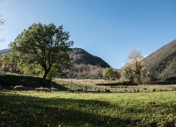
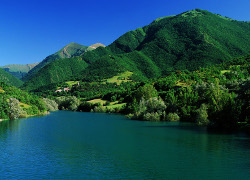
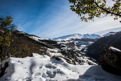
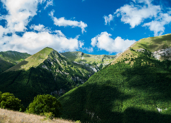
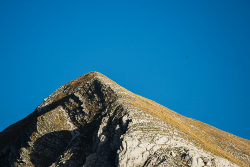
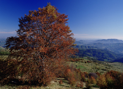
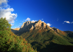
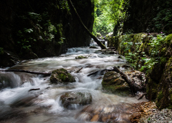
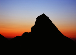
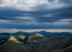
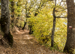
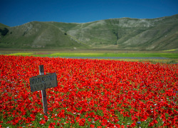
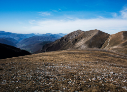
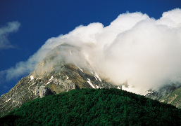
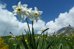
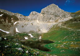
Livestock farming, which has always been practised in the Sibyllines, has, over the centuries, created a dense network of paths leading from the inhabited centres to the highest peaks where the main pastures opened up, used by the migratory herds for summer grazing. The old tracks can be used to make a huge number of walking routes. Here, we suggest 17 of the best routes for exploring the different scenery and nature that the Park has to offer. The starting and finishing points of each route are indicated, as well as technical data, descriptions, and the relevant numbering. The durations are calculated allowing for stops so “you can catch your breath” and take in the amazing countryside and small treasures of the Sibyllines Mountains. Please note that, if you are walking without an expert guide, you must have plenty of trekking experience since the paths are not yet fully signed. It is advisable, in any case, to obtain local information on the conditions of the paths that you intend to follow. Particular attention must be paid to the period in which you intend to go on walking, especially during the winter months and in early spring. Some paths lead to the highest peaks of the Sibylline Mountains, which are often covered with heavy snow, or pass through ravines and valleys that could be at risk of avalanches.


The Silence of the Hermitages


Lenght: 7700 mt.  
Direction of travel: Due sensi  
Hiking time: 3h 30' (andata)  
Difficulty: EE - For experienced hikers  

Access 1: Lago di Fiastra
Access 2: Nei pressi della fraz. Monastero - Fiastra

partially open

Among Chamois and Eagles


Lenght: 2700 mt.  
Direction of travel: Due sensi  
Hiking time: 1h 00' (andata)  
Difficulty: T - Touristic  

Access 1: Nei pressi della fraz. Villa di Mezzo - Bolognola

open

The Hidden Waterfall


Lenght: 5500 mt.  
Direction of travel: Due sensi  
Hiking time: 1h 40' (andata)  
Difficulty: EE - For experienced hikers  

Access 1: Nei pressi della Fraz. Villa Da Capo - Bolognola

open

Pizzo Acuto


Lenght: 6500 mt.  
Direction of travel: Due sensi  
Hiking time: 3h 30' (andata da Bolognola a E6)  
Difficulty: EE - For experienced hikers  

Access 1: Villa Da Capo - Bolognola

open

In the Presence of the Queen


Lenght: 18000 mt.  
Direction of travel: Antiorario  
Hiking time: 6h 30'  
Difficulty: EE - For experienced hikers  

Access 1: Fraz. Campolungo - Amandola

partially open

The Paths of Faith


Lenght: 7700 mt.  
Direction of travel: Antiorario  
Hiking time: 2h 10'  
Difficulty: E - For hikers  

Access 1: Sant.rio Macereto - Visso
Access 2: Loc. I Torrioni - Visso

open

In the Kingdom of the Chamois


Lenght: 14400 mt.  
Direction of travel: Due sensi  
Hiking time: 5h 10' (da Frontignano)  
Difficulty: EE - For experienced hikers  

Access 1: Arrivo seggiovia Cornaccione - Ussita
Access 2: Fraz. Frontignano - Ussita

partially open

The Terrifying Gorge of the Infernaccio


Lenght: 14900 mt.  
Direction of travel: Due sensi  
Hiking time: 7h 00' (andata)  
Difficulty: EE - For experienced hikers  

Access 1: Nei pressi della Fraz. Rubbiano - Montefortino

partially open

On Magic Mountain


Lenght: 11800 mt.  
Direction of travel: antiorario  
Hiking time: 4h 10'  
Difficulty: EE - For experienced hikers  

Access 1: Rifugio Sibilla - Montemonaco

open

Land of the Deer


Lenght: 14900 mt.  
Direction of travel: antiorario  
Hiking time: 5h 30'  
Difficulty: EE - For experienced hikers  

Access 1: Fraz. Nocelleto - Castelsantangelo

open

Nature on the Doorstep


Lenght: 13400 mt.  
Direction of travel: orario  
Hiking time: 4h 10'  
Difficulty: E - For hikers  

Access 1: Fraz. Borgo - Preci

open

Upon the Vanished Lake


Lenght: 21900 mt.  
Direction of travel: antiorario  
Hiking time: 6h 00'  
Difficulty: E - For hikers  

Access 1: Castelluccio - Norcia

open

From the High Hills to the Mountains


Lenght: 10700 mt.  
Direction of travel: antiorario  
Hiking time: 5h 40'  
Difficulty: EE - For experienced hikers  

Access 1: F.ca Di Ancarano - Preci

partially open

A Hard Life Up High!


Lenght: 11800 mt.  
Direction of travel: due sensi  
Hiking time: 5h (andata)'  
Difficulty: EE - For experienced hikers  

Access 1: Chiesa S.ta Maria In Pantano - Montegallo
Access 2: F.ca di Presta - Arquata del Tronto

open

Between Two Parks


Lenght: 11200 mt.  
Direction of travel: orario  
Hiking time: 5h (andata)'  
Difficulty: EE - For experienced hikers  

Access 1: Fraz. Borgo - Arquata Del Tronto

open

In the Footsteps of Guerrin Meschino


Lenght: 13700 mt.  
Direction of travel: DUE SENSI  
Hiking time: 4h 40'(andata)'  
Difficulty: EE - For experienced hikers  

Access 1: Fraz. Foce - Montemonaco
Access 2: Nei pressi della fraz. Castelluccio - Norcia

open

MAPPA