A Hard Life Up High!


Lenght: 11800 mt.  
Direction of travel: both  
Hiking time: 5h (andata)'  
Difficulty : EE - For experienced hikers  
Path: Forca di Presta – M.te Vettore - S.ta Maria in Pantano(sentieri: 101-131 o viceversa) ;

stato: open

From Forca di Presta to Santa Maria in Pantano


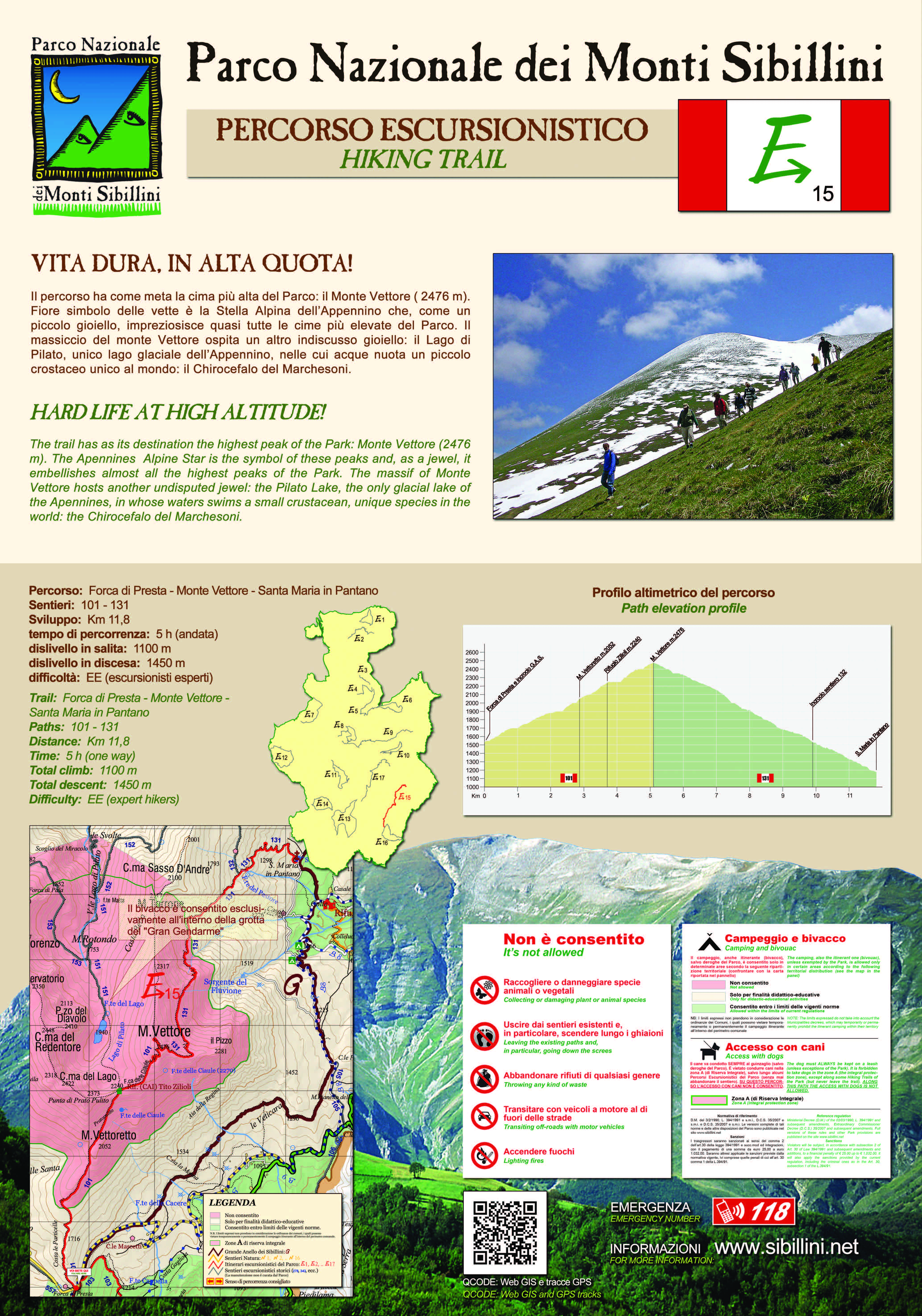
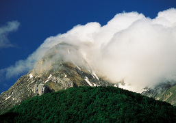
The path, which can start either from Forca di Presta or from Colle di Montegallo, reaches the highest peak of the park: the summit of M. Vettore (2476 m.). The species living at this altitude have adapted to the severe weather conditions. A famous flower, which is the symbol of the peaks of the Apennines, is the Stella Alpina. This little white jewel adorns almost all the highest summits in the Park. The massif of M. Vettore hosts another undisputed jewel: the Lago di Pilato, the only glacial lake in the Apennines, in whose water swims the Chirocefalo Marchesoni, a small crustacean that is not to be found anywhere else in the world.


STATUS OF THE ROUTE DETECTED AFTER THE EARTHQUAKE OF 2016
Trail not yet subjected to maintenance.

Map of the ordinances and limitations in force due to the earthquake

Map of the ordinances and limitations in force due to the earthquake

MAPPA


Banned dogs No access to bicycles Drones - No fly zone go to the photo gallery Go to the cartographic portal Download georeferenced maps and GPS tracks Download the route for Google Earth
 

TOUCH DISPLAY


go to the route E1   go to the route E2   go to the route E3   go to the route E4   go to the route E5   go to the route E6   go to the route E7   go to the route E8   go to the route E9   go to the route E10   go to the route E11   go to the route E12   go to the route E13   go to the route E14   go to the route E15   go to the route E16   go to the route E17  
Attention, opaque links correspond to paths that are currently closed.


Go to Great Sibilline Ring   Go to the nature trails
consult the website of the weather alerts of the Marche Region consult the website of the weather alerts of the Umbria Region