
Between Two Parks
Lenght: 11200 mt.
Direction of travel: clockwise
Hiking time: 5h (andata)'
Difficulty : EE - For experienced hikers
Path: Arquata del Tronto – Forca di Presta – Arquata del Tronto (104 - 103);
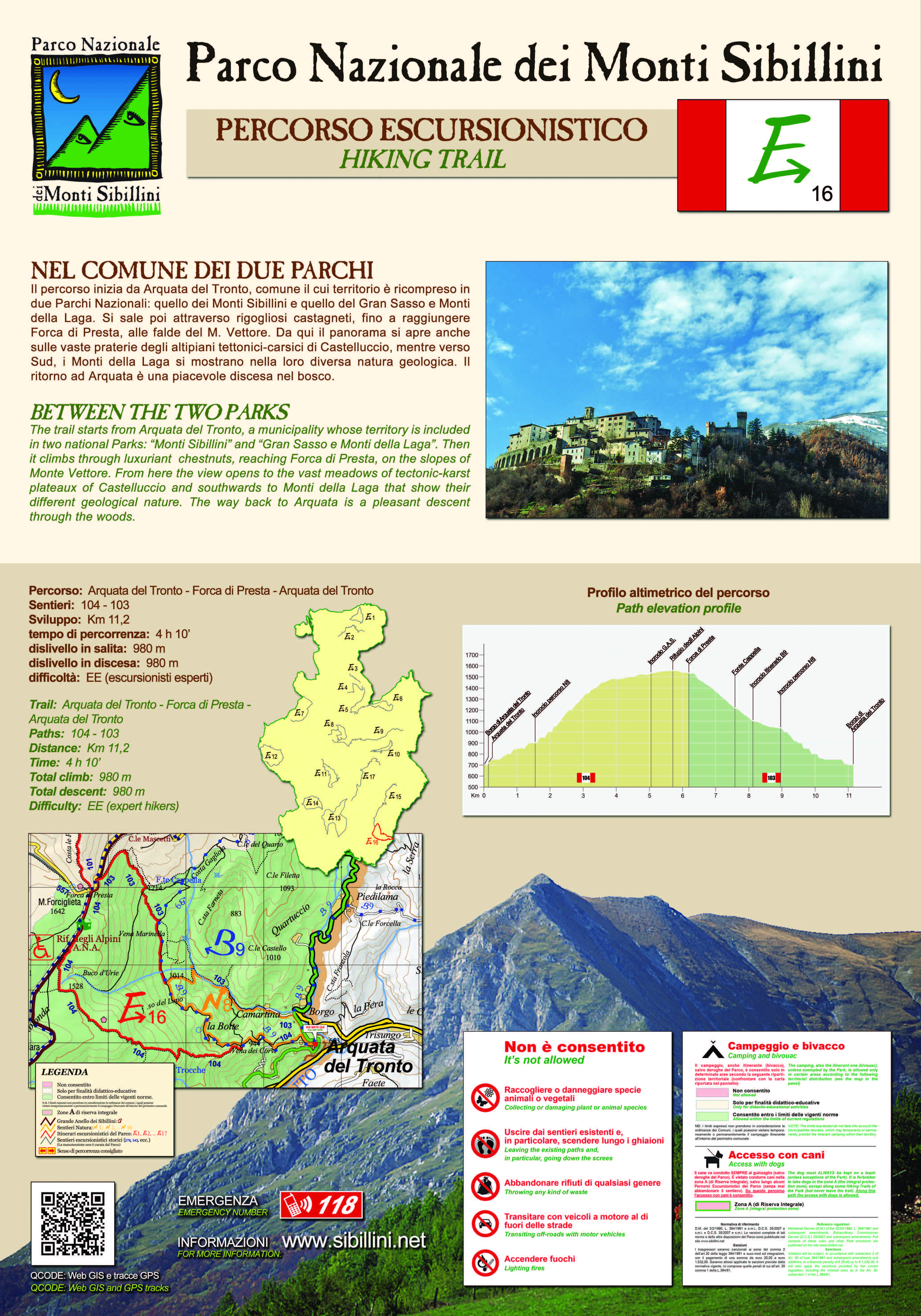
The route starts in Arquata del Tronto, whose territory forms part of two national parks: the Monti Sibillini and Gran Sasso and Monti della Laga. The path climbs through lush chestnut groves, reaching Forca di Presta at the foot of M. Vettore. From here there is a view of vast, high altitude grasslands of the tectonic-karst plain of Castelluccio. Toward the south the Monti della Laga show a different geological nature as they are comprised mainly of arenaceous marl. The area is important for birds of prey and it is not unusual to see the majestic flight of the golden eagle. Returning to Arquata makes for a pleasant descent through the woods.
STATUS OF THE ROUTE DETECTED AFTER THE EARTHQUAKE OF 2016
Open hiking trail under maintenance.
* Due to the 2016 earthquake, the hamlet of Borgo is forbidden to transit, this trail is walkable starting from both Forca di Presta and Camartina. You can close the ring path by a detour between Camartina and Vena dei Corvi to avoid passing through the restricted town centre