

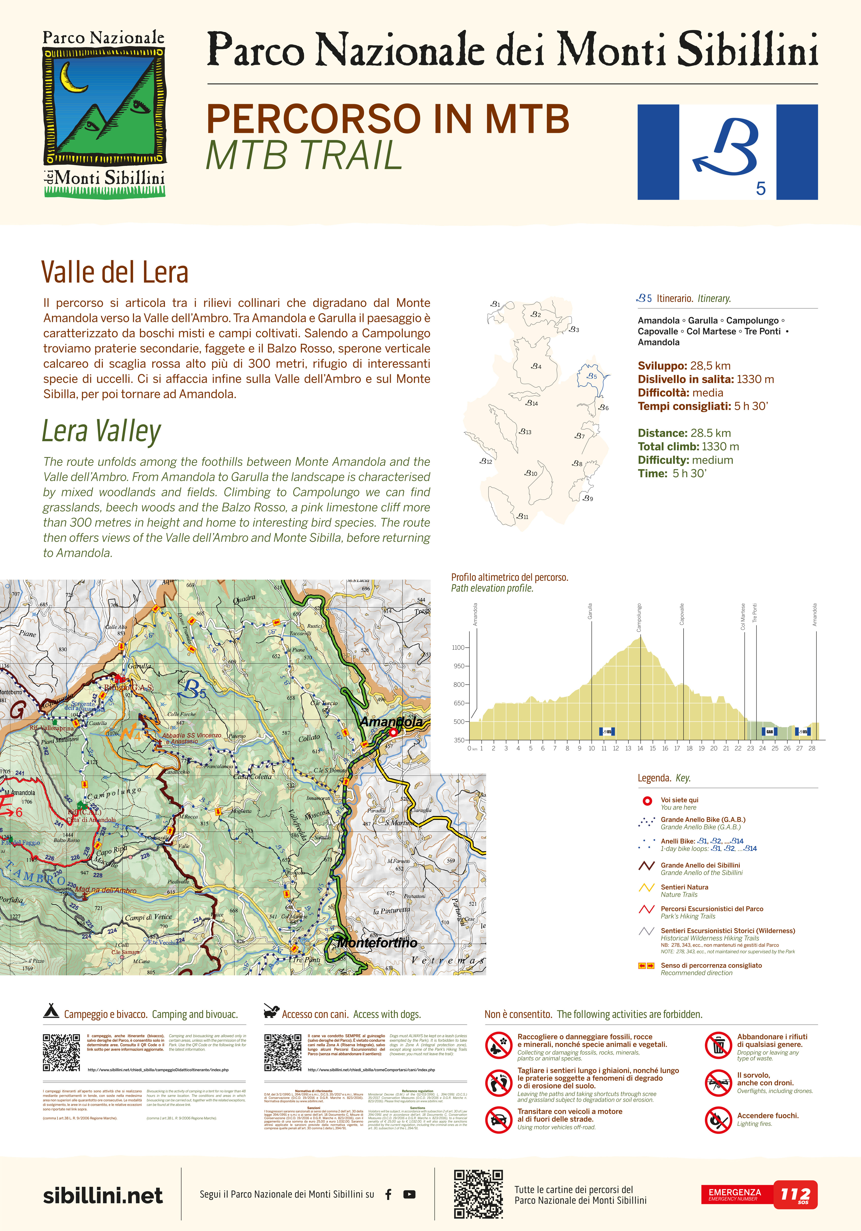
Valle Del Lera
Length: 28500 mt.
Direction of travel: antiorario
Travel time: intera giornata
difficulty : I - Intermediate

This route starts from the town of Amandola and extends among the foothills that slope toward the valley of the river Tenna. Amandola has several distinctive religious buildings such as S. Agostino, the convent of S. Bernardino (sec. XVI) and the church of S. Francesco (sec. XIV). Within the latter, in an adjoining building, there is the museum of farming culture as well as the Visitor Centre and also an anthropogeography Park museum. The route proceeds upward to the hamlets of Vidoni and Garulla where the landscape is characterized by mixed forests and small fields, both cultivated and re naturalized. The diversity of this hilly environment where the level of nature has spontaneously increased in recent decades, offers an ideal habitat for many animal species such as wild cats, deer, porcupines, wild boar and wolf. At Campolungo there are large ‘secondary' grasslands and beech forests. Soon after one reaches the base of the Balzo Rosso, a vertical red limestone rock face more than 300 meters high, where many interesting birds nest, including the red winged wall creeper, the mountain crag martin, and the black redstart. At this point the trail overlooks the lush valley of Ambro and the area leading to the entrance of the Infernaccio gorge, dominated by the legendary Monte Sibilla (2175 m), before returning to Amandola.


Copyright © 2001-2025 Parco Nazionale dei Monti Sibillini
Tutti i diritti riservati - all rights reserved
Revised -- 08.10.2025
URL:
percorsiE.php


