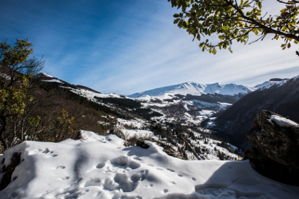
Among Chamois and Eagles


Lenght: 2700 mt.  
Direction of travel: both  
Hiking time: 1h 00' (andata)  
Difficulty : T - Tourist  
Path: Bolognola (Villa di Mezzo) - Fonte dell'Aquila (N14 - 314);

stato: open

From Bolognola to the Fonte dell'Aquila


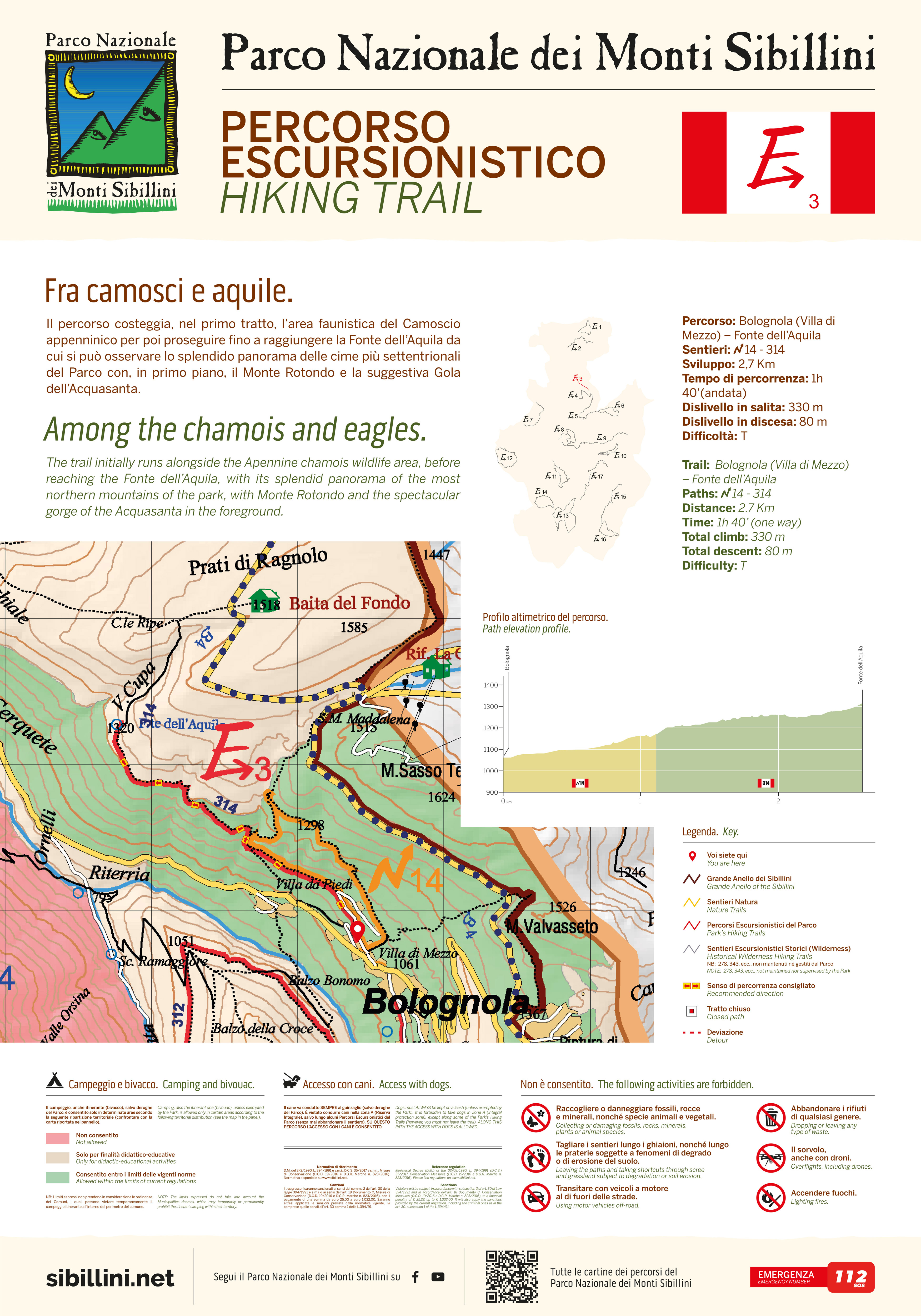
The first section of the route runs through a habitat area of the rare chamois and then continues to the Fonte dell'Aquila where one can observe a splendid panorama of the peaks of the northern end of the Park, including M. Rotondo and the evocative Gola dell'Acquasanta in the foreground.


STATUS OF THE ROUTE DETECTED AFTER THE EARTHQUAKE OF 2016
Open hiking trail under maintenance

Map of the ordinances and limitations in force due to the earthquake

Map of the ordinances and limitations in force due to the earthquake

MAPPA


Access to dogs allowed Access to bicycles allowed Drones - No fly zone icon go to the photo gallery Go to the cartographic portal Download georeferenced maps and GPS tracks Download the route for Google Earth
 

TOUCH DISPLAY


go to the route E1   go to the route E2   go to the route E3   go to the route E4   go to the route E5   go to the route E6   go to the route E7   go to the route E8   go to the route E9   go to the route E10   go to the route E11   go to the route E12   go to the route E13   go to the route E14   go to the route E15   go to the route E16   go to the route E17  
Attention, opaque links correspond to paths that are currently closed.


Go to Great Sibilline Ring   Go to the nature trails
consult the website of the weather alerts of the Marche Region consult the website of the weather alerts of the Umbria Region